Overview | Ice Jam Event Details | Ice Breaking Demonstration Details | Ice Control Structure
In 2004, Alcoa identified a candidate location for an interim (and possibly longer term) Ice Control Structure (ICS) on the Louisville stretch of the Grasse River (upstream of Massena). The type of ICS proposed was a pier type structure (see photos below) designed to trap the ice during the spring breakup and prevent it from moving downstream to the lower Grasse River where the 2003 ice jam event occurred. This ICS site was selected based on its physical characteristics as it was at a location suitable for capturing the major source of ice pieces that can jam against the intact ice cover on the lower Grasse River and it included sufficient floodplain area to allow bypass of elevated river flows that can occur at an ice jam as a result of river stage increases.
It was anticipated that construction of the ICS in Louisville would be part of the 2005 Remedial Options Pilot Study (ROPS); however, this location was not pursued further due to community concerns related to the proposed location. As part of this dialogue, input was received from the community to evaluate whether restoration of the deteriorated weir in the Village of Massena could be integrated into some form of ice control approach. This request was based on interest in the community to see water levels upstream of the weir returned to the levels that existed prior to the breach of the weir in the mid 1990s. Community interest in restoration of the weir has also been reflected through the Massena Local Waterfront Revitalization Plan activities as well as resolutions that were passed by the Village of Massena and the Town of Louisville.
Although restoration of the existing weir was determined to not be a feasible location for an ICS based on the site characteristics, Alcoa agreed to conduct additional evaluations of other possible locations and re-evaluate other potential interim options for ice management. In addition, as part of the 2005 ROPS, the company removed a significant quantity of PCB-containing sediment in the ice scour prone reach of the lower Grasse River and placed an armored cap designed to withstand ice jam related scour forces in the river. The armored cap consisted of a bottom layer of sand and topsoil, a middle filter layer of coarser material, and a final top layer of large stones. The cap was successfully placed and has been visually observed via an underwater video camera with the video showing adequate coverage of the armor stone materials over the area. The most recent video shows the armor stone with finer-grained material on top or in between the armor stone.
Additional details regarding this pilot study can be found under the 2005 Remedial Options Pilot Study.
Other potential ICS locations were evaluated in 2005, and a location in the lower Grasse River adjacent to the Alcoa West facility (T6.75) was selected as potentially feasible for installation of an ICS (see figure below). In addition, the Massena Electric Department (MED) approached Alcoa about the possibility of a multi-purpose project which could provide ice management, hydroelectric power, and recreational benefits for the community through restoration of upstream water levels to those that existed prior to the breach of the weir in the Village of Massena. The company is currently providing support to MED through the initial study phases for the project.
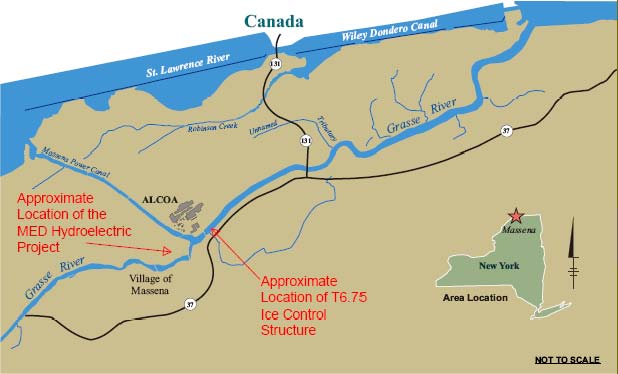
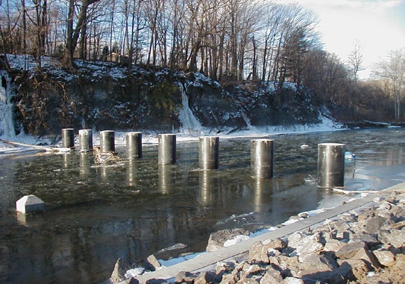
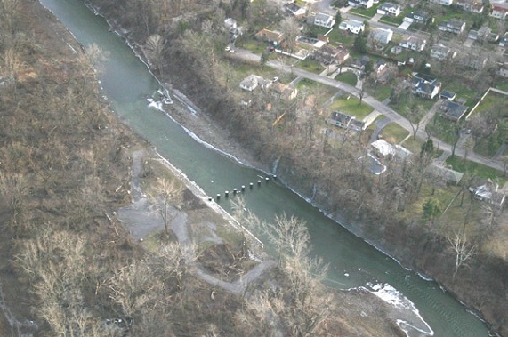
A pier-type ICS is under consideration for the lower Grasse River at T6.75 (see photos of typical pier-type ICS below)
Cazenovia Creek, West Seneca, New York
A pier-type ICS stops ice at the piers, but allows river flow to pass beneath the ice accumulation or through an adjacent floodplain or bypassed channel. Due to a lack of a natural floodplain area in the vicinity of the T6.75 location, the typical design has been modified to include a series of additional piers that form a flow relief channel within the river (see schematic below).
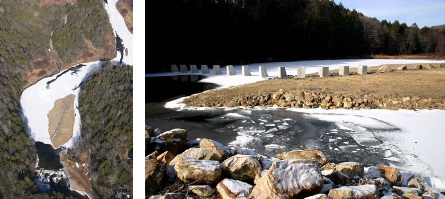
Salmon River, Connecticut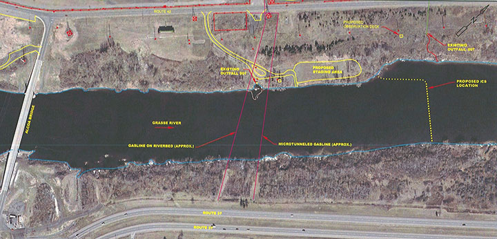
Schematic of T6.75 Ice Retention Piers
In support of evaluating the technical feasibility of the identified structural ice control options, Alcoa conducted a number of studies including:
- Use of state-of-the-art computer based ice modeling (DynaRICE) to evaluate ice retention capabilities and projected backwater effects. This work is being conducted by Clarkson University.
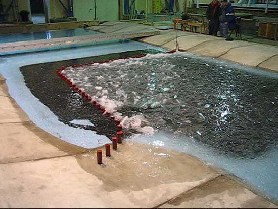
- Construct and test large scale physical and flume models of the lower Grasse River (T6.75) ICS site and a flume model for the MED hydroelectric dam site in a specially designed refrigerated testing facility at the United States Army Corps of Engineers Cold Regions Research Engineering Laboratory (CRREL) (see photos below).
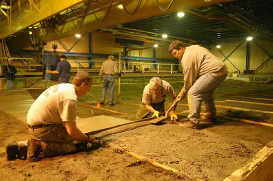
Model preparationg of Grasse River bottom
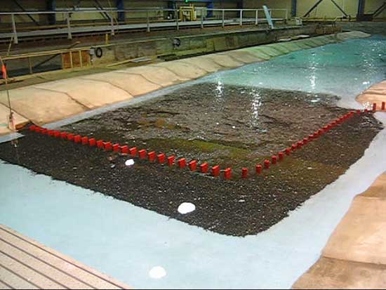
Ice drifting towards piers
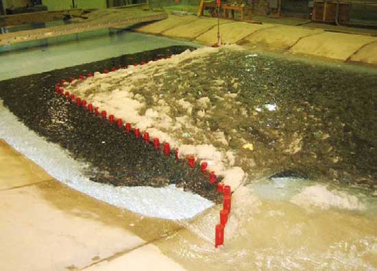
Ice accumulating at piers and thickening
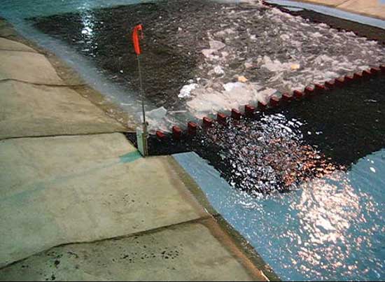
Ice starting to "bleed" through gaps between piers
Alcoa sponsored a tour of the CRREL physical model testing for members of the Community Advisory Panel and other interested parties in March 2007. Details regarding the tour are summarized in the CRREL Physical Model Community Group Tour Trip Report.
The results of the modeling and engineering evaluations conducted for the ICS at T6.75 were compiled and submitted to EPA. This report summarized the findings and next steps for the study, and will be made publicly available once approved by EPA.
The MED hydroelectric project is currently in the initial study phase under the oversight of the Federal Energy Regulatory Commission (FERC).
Back to top